Where bison roam
‘Precision ag for wildlife’ uses drones and data to track bison and invasive plants in Theodore Roosevelt National Park
Fitting a bison with a GPS tracking collar is about as challenging as you’d expect.
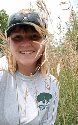
“It’s nerve-wracking,” said Jenna Folluo, a second-year biology master’s student at UND who helped “collar” bison, which weigh between 1,000 and 2,000 pounds, at Theodore Roosevelt National Park in 2017. “We’re very safety conscious. There’s a lot of maneuvering and waiting to get within 30 yards of the herd. Even the female bison are taller than me. I feel small all the time, but I feel extra small next to a bison.”

The team included Biology Professor Robert Newman, resource management biologists from the National Park Service, and members of the U.S. Geological Survey. After tranquilizing females, they fitted them with GPS tracking collars and took hair and DNA samples.
“The hair is very coarse, and the skin is a dull, leathery, matted color,” Folluo said. “It didn’t feel like I anticipated.”
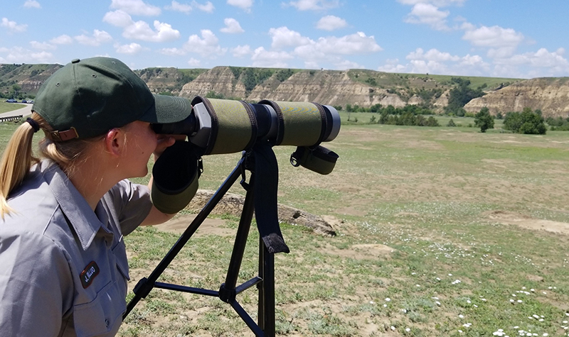
Folluo and Newman have spent the past two summers in the park, working to detect and map invasive plants and to analyze where bison roam.
“Last summer I lived in the North Unit of the park,” Folluo said. “There are no people. It’s quiet and serene, and you can hear the coyotes. You’ll round a butte and see a bison. It’s awesome and breathtaking. I couldn’t ask for a better work desk than the outdoors.”
Newman calls their work “precision ag for wildlife.”
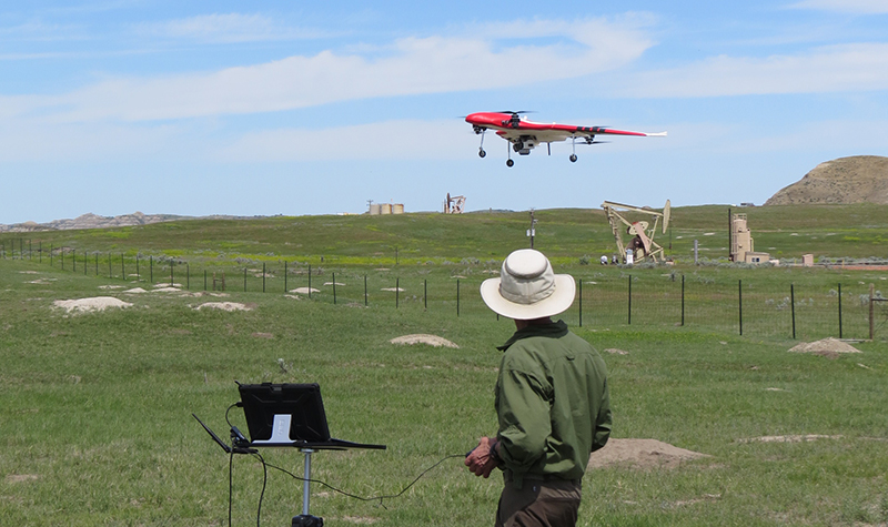
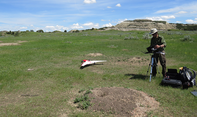
They use UAS (unmanned aircraft systems), satellite imagery and big data to track both bison and invasive plants, especially leafy spurge and Canada thistle.
The scourge of spurge
Leafy spurge, enemy to farmers and ranchers across the Midwest, is an invasive plant with bright yellowish-green blossoms that can cause mouth blisters in animals. Canada thistle, a thorny plant that thrives on prairies and grasslands, can release toxins that poison other plants. Both weeds spread quickly and curtail grazing area.
“Invasive species are one of the biggest ecological problems in the world,” said Newman. “They show up where they don’t have a history. They disrupt the ecosystem and make it harder for native plants to thrive.
“Large mammals such as bison, pronghorn antelope, horses, and others are all plant eaters,” Newman continued. “Knowing how the plants are growing and which types are where is very useful for understanding where animals spend time and how they are doing.”
Drones generate big data that can help pinpoint patches of invasive plants so park staff can locate and control weeds in the 110-square-mile park, which has few roads. That reduces the chance of weeds spreading, makes neighboring landowners happy, and results in more forage for large mammals such as bison.
Data driven
Newman began thinking about using UAS for his work back in 2008, when a former vice president for research asked if he was interested in the technology.
“It took seconds to say yes,” Newman said, adding that land in the park is hard to access, aerial photography is very expensive, and high resolution satellite data can cost tens of thousands of dollars. UAS is less expensive, can be flown nearly anywhere in the park, and can be deployed at peak flowering to better map weeds.
With funding from ND EPSCoR (North Dakota Established Program to Stimulate Competitive Research) and the College of Arts & Sciences, Newman was able to buy a drone and other equipment.
He uses UAS to take high-resolution images of the park, then uses “big data” computational methods to categorize and map both the wildlife and invasive weeds. He and his graduate students, including Folluo, spend the academic year analyzing the data. They are also working to “teach” the computer to detect invasive species because, even though the human eye works very well with small-scale images, only computers can efficiently scan very large data sources.
“While we were flying the drone, we were able to do more than detect invasive plants,” he said. “We were able to classify the entire landscape – sagebrush, trees, and types of grass.”
Accurate vegetation maps across entire landscapes offer the potential to improve understanding of bison and other large mammal movement patterns.
“We can estimate range health, where the bison are going, how long they are in the area, what triggers them to move, the condition of plant growth,” Newman said. “How large is the bison population? Can it be supported? Can we track how the ecosystem responds to weather variations?”
Big project, big data
The project fits in well with the One UND Strategic Plan and three of its Grand Challenges: energy and environmental sustainability, autonomous systems and big data.
“This is a collaborative project,” Newman said, adding that they partner with the National Park Service and the U.S. Geological Survey to do the work. It’s also interdisciplinary, and includes geography and computer science.
Folluo spends the academic year and winters analyzing images and data.
“My UND experience has been great,” said Folluo. “Faculty are available and willing to help. We’re a giant team, and everyone wants everyone else to succeed. It’s been a really positive experience.”