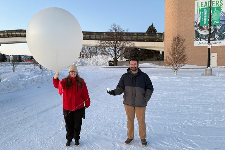
UND scientists study how cloud seeding affects hail in western North Dakota
UND researchers will use radar, satellites and AI models to help determine whether cloud seeding is reducing hail damage
Editor’s note: In the UND LEADS Strategic Plan, the Discovery core value calls on the University to “enhance and deepen UND’s Grand Challenge areas which foster and sustain cross-disciplinary teams dedicated to identifying solutions to pressing challenges.” One of UND’s six Grand Challenges is Rural Health and Communities, and this story — which was originally published in UND Today on Dec. 16 — explains how UND researchers are researching the weather, a central element of rural North Dakota life.
####
A new research project at UND will take a close look at how cloud seeding is affecting hail in western North Dakota, and what that means for the people who live and work there.
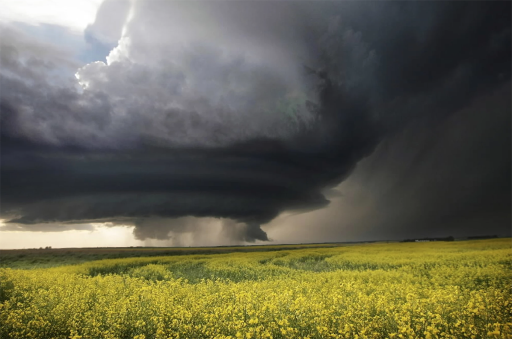
Hail can damage crops, livestock, homes, vehicles, aircraft on the ground and local businesses, leading to costly repairs, lost income and safety risks for people caught in severe storms. For decades, the North Dakota Cloud Modification Project (NDCMP) has seeded thunderstorms in hopes of reducing hail damage and supporting agriculture. But a key question remains: Is cloud seeding really making a difference in the size and impact of hail?
Funded by the North Dakota Department of Water Resources, the project is led by principal investigator Marwa Majdi and co-investigator Mounir Chrit, both assistant research professors in the Department of Atmospheric Sciences at UND, with doctoral student Lynnlee Bestul contributing as a key member of the research team.
Why cloud seeding matters for North Dakota
For more than 50 years, the North Dakota Cloud Modification Project has seeded thunderstorms in western North Dakota to reduce hail damage to crops. Pilots fly into selected storms and release tiny particles into the clouds to encourage many small ice particles instead of a few large hailstones. This collaboration between UND and the NDCMP is not new. UND atmospheric scientists have supported the program for many years through earlier hail and cloud physics projects, providing scientific guidance, evaluation tools, hailstorm forecasts from weather model simulations, and student training. This new project builds on that long history and takes the collaboration to a more advanced level.
Hailstorms do more than damage fields. They can break windows and roofs, dent cars and farm equipment, shut down businesses and affect airports, runways, and aircraft parked on the ground. When severe hail is expected or hits unexpectedly, flights may be delayed, vehicles and outdoor workers must be moved to shelter, and communities face higher repair bills and insurance costs.
All of this has real economic impacts for families, businesses, and local governments, and it raises important questions about how best to protect people and property.
“Farmers, producers and communities are asking a very fair question: Is seeding doing what we think it is doing?” Majdi asked. “Our task in this project is to give them clear, defensible numbers they can understand and use.”
Earlier work by graduate student Lynnlee Bestul found signs that seeded storms may produce smaller hail than storms that were not seeded, but that study covered only a few years and relied mainly on radar and model guidance.
“This new project lets us extend that work over more seasons and use more powerful tools,” Majdi said.
Chrit emphasized the importance of the long-term relationship between UND and the state.
“North Dakota has trusted UND with tough weather questions for many years,” he said. “This project is another chance to give the state practical answers it can actually use.”
How the team will study cloud seeding and hail
In this project, UND researchers will first build a detailed database of storms from 2016 through 2024 in western North Dakota, focusing on counties that take part in the North Dakota Cloud Modification Project. Using NDCMP flight logs, each storm will be labeled as seeded or unseeded. For every storm, the team will extract what dual-polarization weather radar says about where hail formed and how large it likely was, what weather satellite data shows about cloud tops and storm structure, and what weather prediction models say about the environment around the storm, including instability, wind shear and moisture.
These pieces of information will be carefully calibrated for western North Dakota and combined into one consistent storm record.
Once this database is in place, the team will use it to train an interpretable AI system that estimates the chance of small hail (less than 1 inch), medium hail (1–2 inches), or very large hail (greater than 2 inches) in different parts of each storm. By comparing seeded and unseeded storms under similar conditions, the system will measure how often seeded storms appear to produce smaller or less intense hail.
The results will be summarized by county, season and hail-size range, with uncertainty clearly stated so users know how accurate the estimates are.
“Our goal is to move from yes-or-no answers to quantitative, county-level metrics that are easy to understand,” Majdi said. “For example, in this area, during this part of the season, how often did seeding shift storms from very large hail to smaller hail?”
New tools: radar, satellites, weather models and AI working together
In building and applying this AI system, the UND team will connect the same radar, satellite, and WRF model fields described above inside a single fusion framework. Dual-polarization radar will scan deep into storms to show where hail is forming and how strong the storm cores are. Weather satellites will monitor cloud tops from space, tracking tall, intense storm towers and signatures linked to hail. The WRF model will provide the larger-scale conditions — such as instability, wind shear and moisture — that help hail form and grow.
By bringing these views together, the researchers can see both the ingredients that went into each storm and the hail that came out of it. The interpretable machine-learning system will learn from many past storms to produce reliable, size-resolved hail probabilities and to compare seeded and unseeded storms in a consistent, transparent way.
“We are using interpretable machine learning, which means we can still explain why the system makes a given estimate,” Chrit said. “That is important for both science and operations. We want something that weather forecasters and decision-makers can trust, not a black box.”
Cloud seeding in North Dakota has drawn growing attention from farmers, local officials and state lawmakers. Supporters see it as one tool to help reduce hail damage and protect crops, while others are unsure whether it has real benefits or possible downsides. Because public funds and local decisions are involved, there is a strong need for clear, independent evidence on how seeding affects hail.
Long-term benefits for North Dakota
In recent legislative debates and the latest state bill on hail mitigation and cloud seeding, lawmakers, counties and farmers all asked the same question: What are we really getting for this public investment? Clear information on how often seeding helps to reduce the most damaging hail can support decisions that protect people, property and the broader state economy.
This project is designed to answer that question with clear, independent evidence. “North Dakota has invested in cloud seeding for decades,” Majdi said. “With this project, we’re giving the state its clearest picture yet of how that investment is performing under today’s storms and tomorrow’s climate, so decisions can match what the data really show and better protect communities, businesses, and critical infrastructure.”
####
>> Questions or comments about the UND LEADS Strategic Plan? Your thoughts are welcome! Please contact Ryan Zerr, associate vice president for Strategy & Implementation, or Anna Marie Kinney, coordinator of the University Writing Program, the co-chairs of the UND LEADS Implementation Committee. You also may offer your thoughts by visiting the UND LEADS Strategic Plan home page and clicking on the “Provide your feedback” link.
Thank you for your support of the UND LEADS Strategic Plan!